
Monitoring Episodic River Inflow Plumes Using In-Situ and Remote Sensing Data
- Status: Funded by Illinois-Indiana Sea Grant through EPA Great Lakes Restoration Intiative (GLRI) funding
- Duration: September 2010 to August 2012
- PI: Keith A. Cherkauer, Agricultural and Biological Engineering, Purdue University
- Co-PIs: Indrajeet Chaubey (ABE, Purdue) and Cary Troy (CE, Purdue)
- Graduate Students: Jing Tan (ABE, Masters) and Rebecca Essig (CE, Masters)
Project developments
Latest Developments
Our first sampling trip will be May 3rd, and continue through the summer following the Landsat 5 overpass schedule.
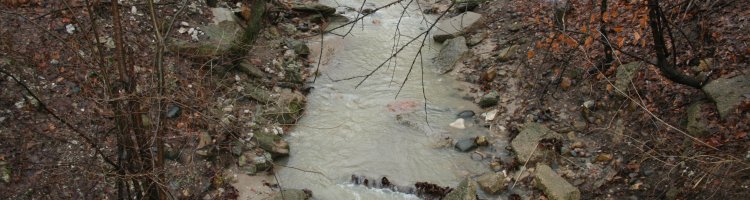
We have selected an installation location for our water sampling equipment on Burns Ditch in northern Indiana, and have worked out an agreement with the Indiana Department of Natural Resources (IDNR) to use the site, construct a shelter and get help in the installation of the equipment. As part of site selection, we have also analyzed the USGS streamflow records for the sites to identify sites that are minimally impacted by lake conditions. There has also been a field site scouting trip to confirm our ability to access stream channels to collect water and spectral samples.
We are working on procedures for collecting quality spectral reflectance data over a water surface, by using the Purdue owned GER 1500 spectrometer to look at the Wabash River and other local water bodies. The techniques developed over the winter and early spring will be used to collect data over river outlets and lake plumes once we start the spring sampling season in the next month.
We have been meeting with the USGS and team members of a separate Sea Grant proposal run through Purdue that will be studying the interaction of fish populations and river plumes along the same coastal area on which we are focused. We are planning to coordinate plume sampling with the Sea Grant funded team, to the benefit of both groups.
At this time, we are ready to start the spring sampling campaign.
Project Summary:
Excess concentrations of sediment and nutrients are two primary sources of water quality impairment in the rivers of the Midwestern United States (National Research Council, 2008). Nonpoint source pollution originating from agricultural activities is the dominant source of sediment and nutrients to these rivers (Alexander et al., 2008). With the increased emphasis on biomass for biofuel production, significant land use and land management changes are occurring at a rapid pace in Midwestern watersheds. For example, increased corn production to meet grain-based ethanol production in the near future and increased removal of biomass from the landscape for cellulosic ethanol conversion in the long-term, can potentially increase sediment and nutrient delivery to receiving water bodies, thus exacerbating the current water quality problems in this area. As is already the case in Lake Erie, these increased nutrient and sediment loads into the Great Lakes have a direct impact on the complex food web dynamics of native and invasive aquatic species.
Assessing water quality is critical for its management and improvement. The drainage area of the Great Lakes is influenced by changing land use (changes in forestation, urbanization and agricultural management) and climate. Such a large area is not easily monitored using insitu techniques, nor do these techniques lend themselves to the forecasting of future conditions. This is especially true of the impact of heavy precipitation events on inputs to the Great Lakes. With such precipitation events projected to increase in frequency and intensity in the future (Kling et al., 2003) increasing the frequency of high flows throughout the year in many regional rivers and increasing the flashiness of streams in summer (Cherkauer and Sinha, accepted), there is a need to know more about how such events affect the quantity and quality of river flows into the Great Lakes. Therefore better methods for measuring regional water quality inputs into the lakes are needed, especially those with good spatial resolution that can be used to develop better process or physically based modeling approaches that can in turn be used to forecast lake water quality related to current storm events, as well as serving as a tool for assessing regional land use management strategies for mitigating the worst sources of nutrients and other water quality problems. Remote sensing could be such an alternative means of monitoring water quality over a greater range of temporal and spatial scales than done currently (Dekker et al., 1996). Remote sensing data could also be a valuable source for the retrieval of historic water quality information from unmonitored sites.
We are therefore proposing to use a combination of (1) automated and regular sampling of river water quality to measure baseline and episodic sediment and nutrient loads from two rivers flowing into southern Lake Michigan to quantify the temporal variability of input loads, (2) three dimensional measurements of episodic river plume and surrounding lake water quality variables, and (3) remote sensing from a number of satellite-based platforms to capture the structure of episodic river input plumes. We will supplement this analysis with ship based grab samples of lake water quality and spectral information to quantify river plume nutrient and sediment loads and relate those back to the less direct measurements from the AUV and remote sensing image analysis.