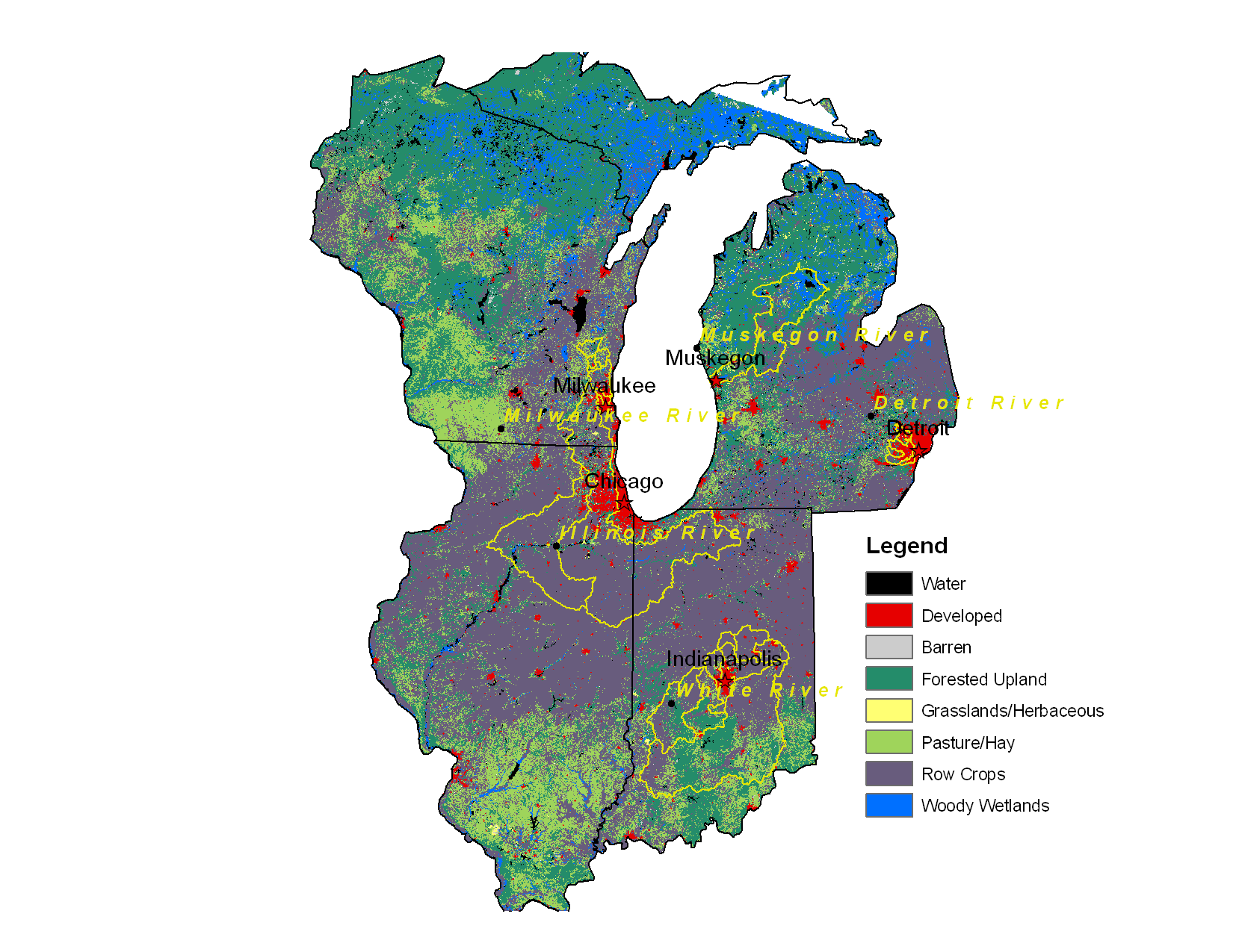
Multisensor/Multiscale Assessment of Urban Impacts in the Great Lakes Region
- Status: Funded by NASA Land Cover and Land Use Change Program
- PIs: Laura Bowling, Keith Cherkauer, Dev Niyogi (AGRY/EAS) and Bryan Pijanowski (FNR)
- Current Students: Ming Lei (EAS), Kim Robinson (FNR), Gavin Yang (AGRY)
- Graduates: Vimal Mishra (ABE), Deepak Ray (FNR)
Recent Activities
Animations of RAMS-simulated precipitation for 5 land cover scenarios.
Pijanowski's land cover forecasts and backcasts in use as electronic exhibits at the American Museum of Natural History.
Objective:
- Develop an integrated modeling tool, incorporating spatial data from multiple sensors, to study the interactions between land-use, weather, and surface hydrometeorology, with a specific focus on the potential impacts of increases in urbanization within Upper Great Lakes region.
Science Questions:
- How has urbanization altered the orientation and/or composition of approaching thunderstorms, and in particular, the hydroclimatology of storm events?How do different sources of data, which are at different resolutions and contain different numbers of land use classes and land cover details, affect the simulated hydrometerologic and energy fluxes?
- How will different future potential land use change trajectories affect climate and water fluxes across different spatial scales?