
Remote sensing of water quality indicators in the Wabash River
- Status: Funded by IWRRC
- Duration: March 2009 to February 2011
- PI: Keith Cherkauer, Purdue University
- Co-PI: Indrajeet Chaubey, Purdue University
- Graduate Student: Jing Tan
Project Summary:
Project developments
Hyperspectral imagery was collected by SpecTIR on May 15th!
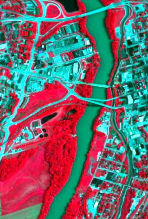
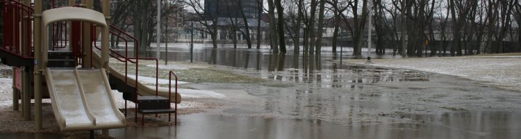
Water quality is a major issue for rivers in the agriculturally dominated Midwestern United States. Most monitoring of water quality relies on the installation of expensive real-time monitoring stations, or the selection of permanent sampling sites where samples are collected by hand. The former results in good temporal resolution but is limited by cost to relatively few locations, the latter method allows the spatial coverage of the samples to increase at the expense of collecting samples less frequently, on a monthly basis for example. Remote sensing imagery has been used to monitor water quality on lakes, reservoirs and costal zones, providing high spatial resolution with relatively regular sampling frequencies interrupted only by clouds, however, their applicability in river ecosystems is not well tested. This project will apply existing techniques for extracting water quality information from remote sensing images, to images of the Wabash River to test the ability of satellite-based sensors to monitor water quality in this and other Midwestern river systems. In-situ water samples and spectral measurements will be collected coincident with satellite overpasses to develop a database of spectral signatures related to current flow and water quality conditions within the river channel. This information will be used to calibrate and evaluate the extraction of water quality parameters, such as chlorophyll-a (chl-a), total suspended solids (TSS) and dissolved organic matter (DOM), from remote sensing images. We expect this project to result in a better understanding of which image processing algorithms are effective and what sensor characteristics are required to produce high-quality maps of the spatial distribution of regional water quality. This will eventually lead to the development of near real-time maps for the evaluation and monitoring of water quality in the region.
Our primary objective for this research is to evaluate existing algorithms for the assessment of water quality in oceans, lakes and reservoirs as applied to river systems in the Wabash River using satellite remote sensing and in-stream sample analysis. Specific research questions that will be addressed are:
- How well do current remote sensing methods do at obtaining water quality measurements for Midwestern Rivers in agriculturally dominated environments, especially when sediment load is the primary pollutant?
- Can we observe inter-seasonal changes in spatially distributed water quality, and how does that differ from what is measured from in-situ observations?