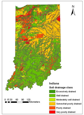
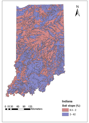
Potentially Drained Area in Indiana
The agricultural land area in Indiana which is likely to have subsurface drainage improvements is being mapped from the National Agricultural Statistic Service (NASS) land cover dataset, as well as soil drainage class and soil slope data from the Natural Resource Conservation Service (NRCS) STATSGO database. This so-called potentially drained area will be identified using the decision tree classifier model developed by Naz and Bowling (2009). The decision tree classifies all the crop land that is some what poorly/poorly/very poorly drained and has an average soil slope of less than 2% as potential tile drained area.
Click on the images below to download Google Earth-compatible layers (*.kmz files) for Indiana.
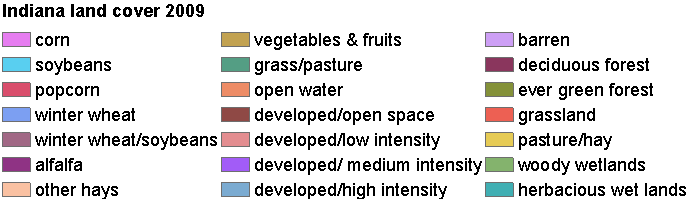
The legend for the Google Earth compatible NASS land cover dataset: