
SWAT Modeling
Research Goal
The major goal of this research is to develop tools in order to provide hydrologic information, to support hydrologic management and decision making in the Department of Arequipa.
Why hydrologic modeling?
Hydrologic information is needed to quantify water availability, hydrologic response to different stressors, and allocate water use within different sectors in the region. Two interconnected river basins of Quilca-Vitor-Chili and Camana provide freshwater for agricultural, industrial, and consumptive use in the region. The Autonomous Authority of Majes (AUTODEMA) provides a good monitoring system of regulated points that are affected by dams and water diversions (Figure 1), but many of them do not have a long historical record so they do not capture the range of climate variability in the region. Hydrologic modeling can help assess water availability including when, where, and how much water is available.
We are using the Soil and Water Assessment tool (SWAT), which is a commonly used hydrologic model all around the world. It is a physically based, semi-distributed model that uses physiographic (e.g. elevation, land cover, soil), and climate (e.g. precipitation, temperature) data to evaluate hydrologic impacts of land use, land management, water regulation, and climate change at the watershed scale. Developed SWAT models can be used to assess hydrologic impact of various water management and regulations in the region, and predict water availability in the future.
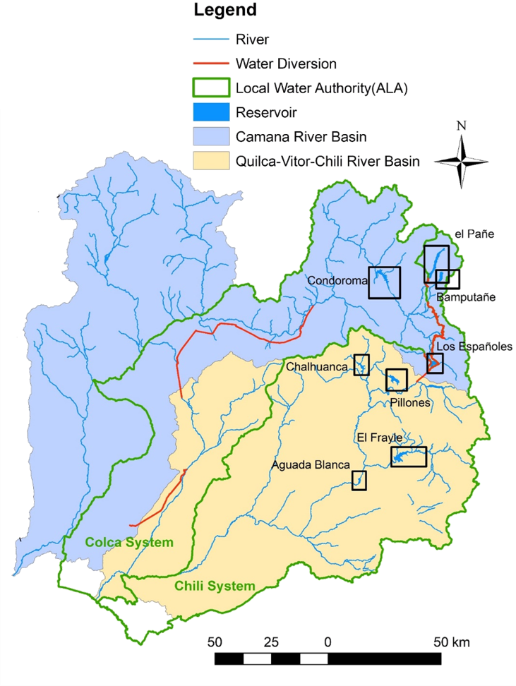
Figure 1. Interconnected River Basins of Quilca-Vitor-Chili and Camana [Eight reservoirs are highlighted with rectangle boxes]
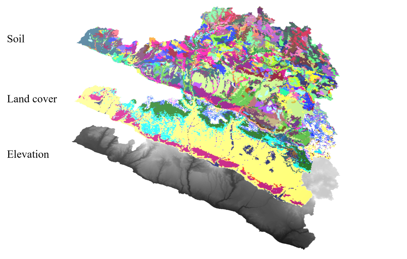
Figure 2. Elevation, land cover, and soil maps of Arequipa department that were used for SWAT model development
Accomplishments
Regional Soil and land cover databases for SWAT
SWAT requires many soil and land cover properties which were not available for the Arequipa department, so we developed methodologies to estimate required properties based on limited available data.
For soil, maps of soil taxonomy and suitability that are available from the Ministry of Environment of Peru (Ministerio del Ambiente, MINAM) were used to create soil classes. Limited soil profile data were linked to soil classes based on their taxonomy and suitability information. Some properties were directly obtained from measured properties, while remaining properties were estimated based on available data. Figure 3 shows the process of obtaining soil properties that are documented in Estimated soil physical properties for hydrologic modeling in Arequipa, Peru.
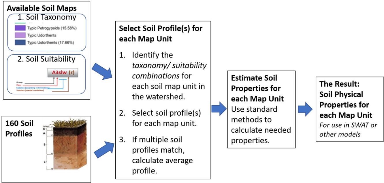
Figure 3. Steps for calculation of soil physical properties
For land cover, a regional map of local classes is available from MINAM, but no physical properties are reported for these local land covers. A methodology was developed to estimate required properties for Peruvian land covers in two steps. First the most equivalent land cover was found from the SWAT database and its properties were assigned to new local land covers. Then parameters related to the seasonal cycle (including maximum and minimum Leaf Area Index (LAI), and optimum temperature for plant growth) were adjusted for local vegetation. Methods and results are documented in Estimated land cover properties for hydrologic modeling in Arequipa, Peru. Figure 4 shows the process to obtain two LAI parameters for the land cover class “Pajonal” (Scrubland) as an example.
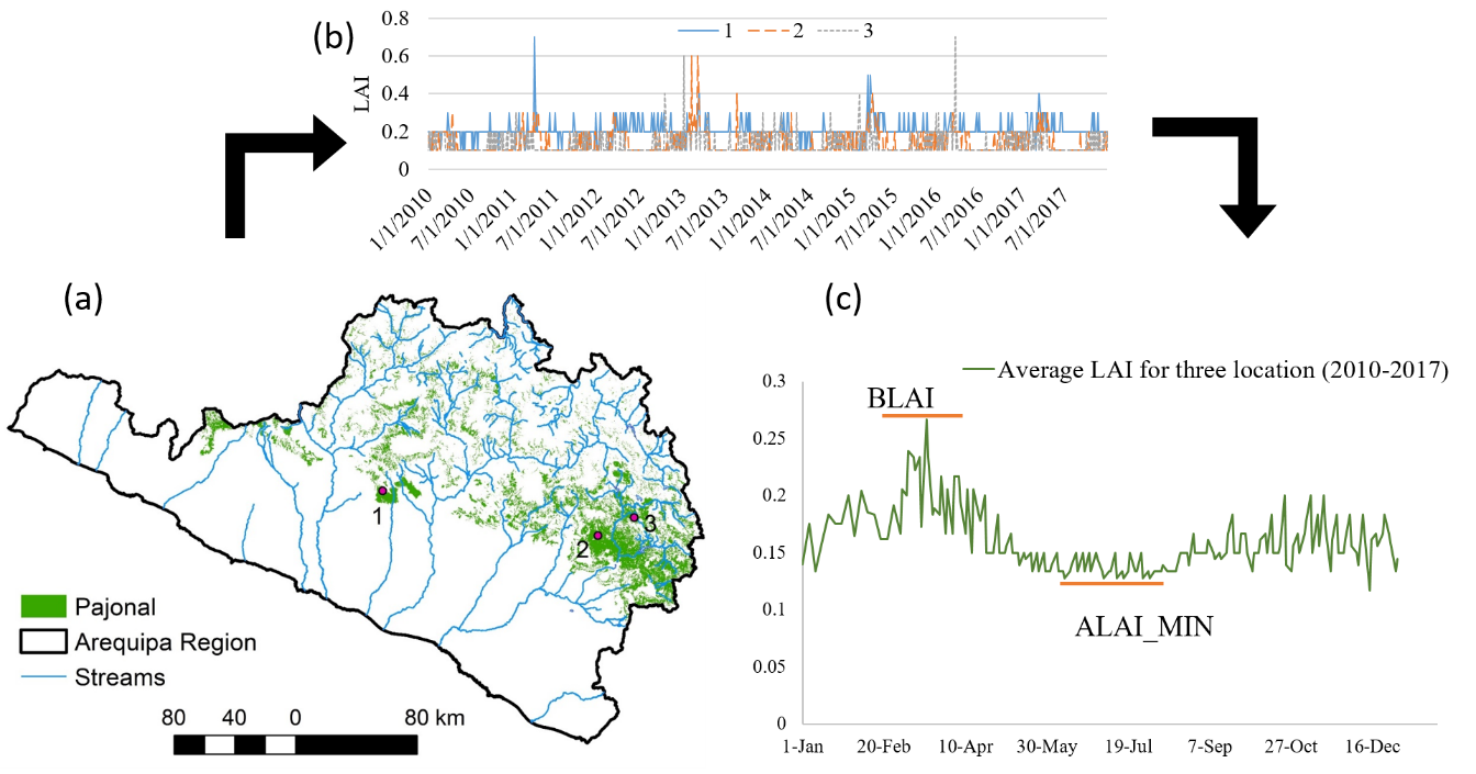
Figure 4. The process to obtain two LAI parameters based on remotely sensed Leaf Area Index (LAI) timeseries for Pajonal
Assessment of the El Frayle Reservoir watershed
We developed a SWAT model for the tributary draining to the El Frayle watershed (Figure 5). Results showed that the databases provide satisfactory prediction of streamflow. Average annual water balance analysis showed that it is a baseflow driven watershed and only 8% of streamflow was generated from the surface runoff. Streamflow is mostly generated from December to April with peaks in February, while it remains below 0.5 mm/month for the rest of the year. This study provided an insight on natural hydrology of the region and a baseline for future studies, and the study was submitted to Journal of Hydrologic Engineering.
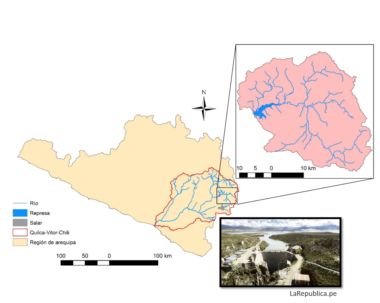
Figure 5. Headwater of Chili River Basin draining to the El Frayle Watershed
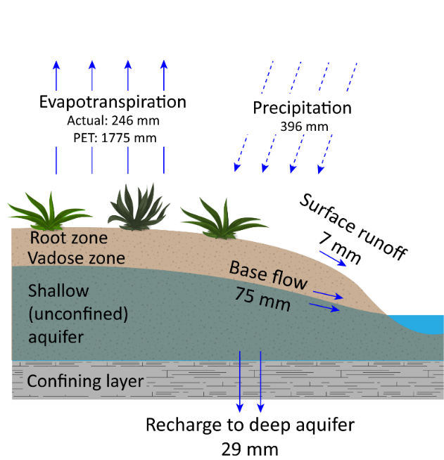
Figure 6. Average annual water balance of the El Frayle watershed
Hydrologic analysis of Torrenteras
A SWAT model was developed to predict sub-daily streamflow in six torrenteras that generate large volume of streamflow in short times (~1-2 hours) during the intense seasonal rains. Simulated streamflow was then used for hydraulic analysis and assessment of flash flood hazards.
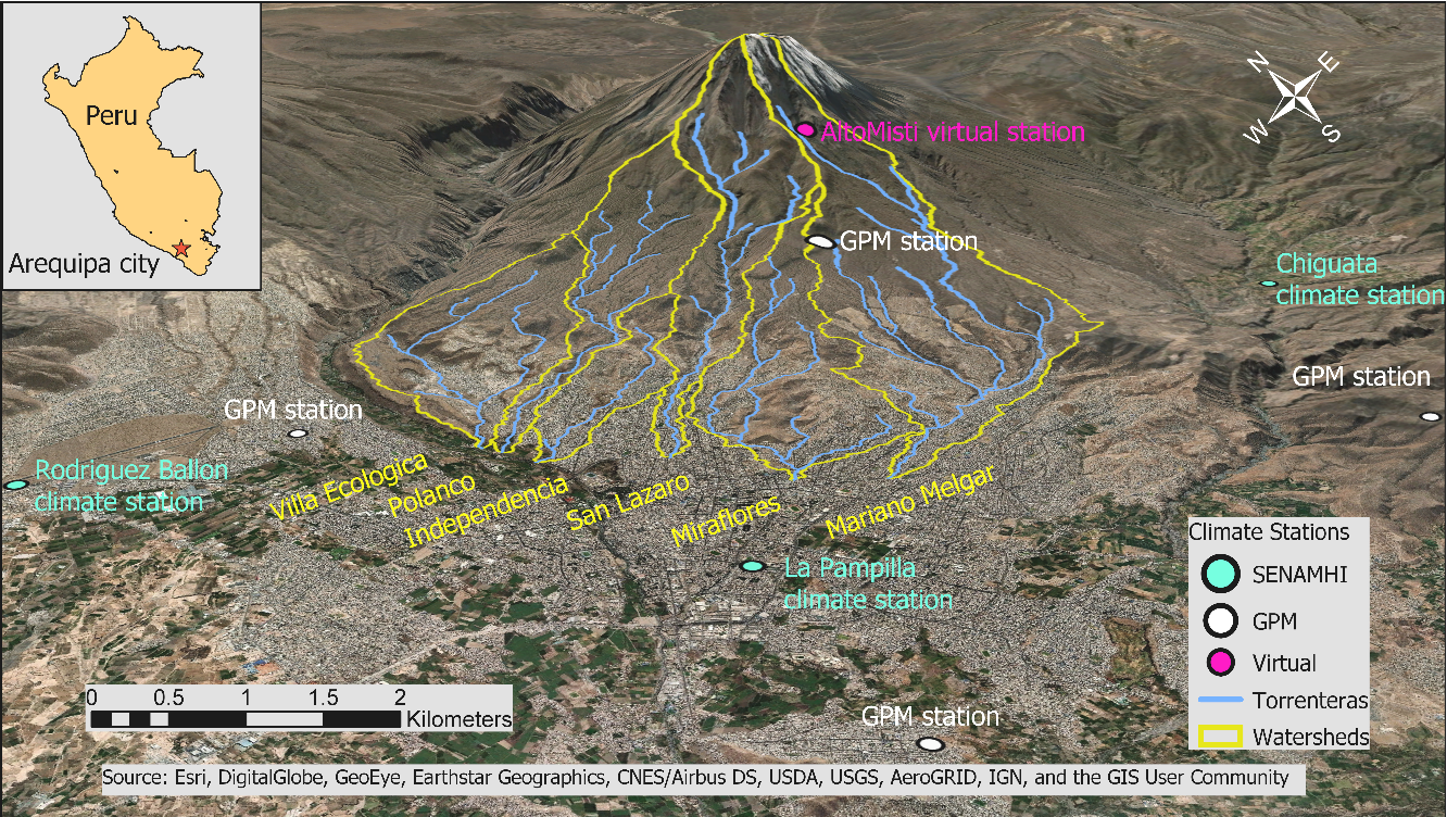
Figure 7. Six torrenteras and their drainage areas
Ongoing Projects
- Developing comprehensive regional models for two interconnected river basins of Quilca-Vitor-Chili and Camana.
- Evaluating impacts of land management and climate change on hydrology of the region.
- Sharing developed models on HidroAQP, an interactive platform to visualize and compare various SWAT simulation results.